Geographic Information Systems (GIS) (Cambridge International IGCSE Geography)
Using GIS
-
Geographic Information Systems (GIS) is digital software which analyses and displays data on maps
-
Each GIS map is made of layers, each of which shows different information
-
The maps can then be used to:
-
Identify correlations and patterns
-
Assist in:
- Urban planning
- Disaster management
- Environmental conservation
-
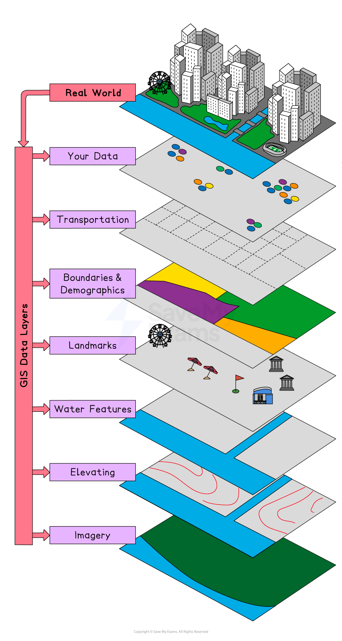
Geographic Information Systems
-
Using GIS software, users can:
- Zoom in and out to different scales
- Turn layers of information on and off
- Add data
-
The complexity of GIS maps depends on the purpose of the map
-
Google Maps is an example of a GIS application
-
Within fieldwork enquiries, GIS can be used either:
- To display primary data
- As a source of secondary data
Benefits & Limitations of GIS
Benefits of GIS
-
GIS applications are used by businesses and governments
-
The use of GIS has several benefits, including:
- Improved decision-making because they clearly show patterns and relationships between different sets of information
- Effective planning for example when making decisions about where to place new housing or an industrial estate
- Market analysis to make decisions such as where to put a new supermarket
- Disaster preparedness and response by examining the areas most at risk
Limitations of GIS
-
GIS can be expensive
-
Inputting the data required can be time consuming
-
Quality GIS output depends on quality data being inputted, which includes:
- The accuracy of data
- Whether the data is up to date
- Consistency between types of data
-
Bias when using GIS is also an issue because:
- Many maps still use the Mercator projection, which distorts the size of countries and regions
- The information shown depends on what is selected by the user
Was this revision note helpful?
Build on this topic